
Mars Hill, NC Guidebook
Cute Towns Nearby
Asheville is a city in western North Carolina’s Blue Ridge Mountains. It’s known for a vibrant arts scene and historic architecture, including the dome-topped Basilica of Saint Lawrence. The vast 19th-century Biltmore estate displays artwork by masters like Renoir. The Downtown Art District is filled with galleries and museums, and in the nearby River Arts District, former factory buildings house artists' studios. Also lots of fun breweries.
904 當地人推薦
Asheville
Asheville is a city in western North Carolina’s Blue Ridge Mountains. It’s known for a vibrant arts scene and historic architecture, including the dome-topped Basilica of Saint Lawrence. The vast 19th-century Biltmore estate displays artwork by masters like Renoir. The Downtown Art District is filled with galleries and museums, and in the nearby River Arts District, former factory buildings house artists' studios. Also lots of fun breweries.
Mars Hill
Weaverville
Hot Springs
Burnsville
Food and drinks
Hickory Nut Gorge Brewery at Mars Theatre
70 S Main StLittle Creek Cafe
11660 U.S. 23Baa'd Sheep Burritos
14 S Main StStackhouse Restaurant
37 S Main StAsheville Brews Cruise
6 Lennox CourtEluvium Brewing Company
11 Florida AveBig Pillow Brewing
25 Andrews Avenue NorthTwin Leaf Brewery
144 Coxe AveWicked Weed Brewing Pub
91 Biltmore AveThe Funkatorium
147 Coxe AveSierra Nevada Taproom & Restaurant
100 Sierra Nevada WayHoppy Trees Beer & Spritz Bar
7 Florida AvenueWell-Bred Bakery & Cafe in Downtown Weaverville
26 N Main St
The Lodge at Wolf Laurel
2521 Wolf Laurel RoadHomeplace Beer Company
321 W Main StSnap Dragon
107 Town SquareAdventure
Wolf Ridge Ski Resort
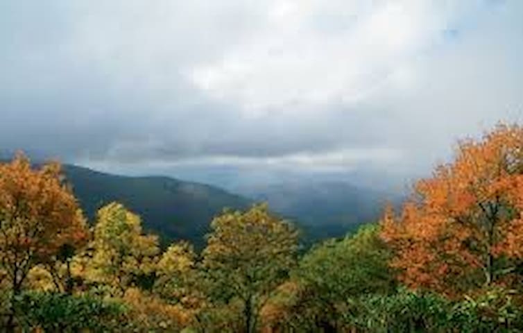
578 Valley View CirSams Gap Access Point is the closest accessible place on the Appalachian Trail to the Mars Hill area or the route on I 26 from Tennessee into North Carolina. It has one of the nicer parking areas for Trail access in Madison County. There is a nice hike for under 2 miles going south to High Rock for a good view.
Going north toward Spivey Gap, Big Bald Mountain (6.5 miles) affords another spectacular 360° view from a high elevation. Big Bald is the highest elevation in Madison County at 5516′. From Sams Gap on the Appalachian Trail, Devils Fork Gap is 8.2 miles and Spivey Gap (in Tennessee) is 13.6 miles.
Sites on the Trail from Sams Gap:
2 miles hiking south to Devils Fork is High Rock which provides a good view when not overgrown with summer vegetation
6.5 miles hiking north to Spivey Gap is Big Bald Mountain where you have 360° views from an elevation of 5516′ which is the highest in Madison County
Driving Directions to Parking: GPS Location: N 35° 57.133’ W082° 33.652’
From Mars Hill: Take I 26 toward Tennessee to Exit 3. At the bottom of the ramp, turn right onto Bear Branch Road and then left onto NC Highway 23A. Stay on NC Highway 23A for 3.1 miles for Parking Access on the left side of the highway just before the I 26 overpass.
Hiking the Trail:
To hike the trail north to Spivey Gap ( 13.6 miles), cross the highway to the gate for the Trail. This trail goes to Spivey Gap which is the next parking access point but is in Tennessee.
To hike the trail south to Devils Fork Gap (8.2 miles), walk under the I 26 overpass to the trail on the left side of the highway. Go up the road and look for the signs on the left side.
Sams Gap
Sams Gap Access Point is the closest accessible place on the Appalachian Trail to the Mars Hill area or the route on I 26 from Tennessee into North Carolina. It has one of the nicer parking areas for Trail access in Madison County. There is a nice hike for under 2 miles going south to High Rock for a good view.
Going north toward Spivey Gap, Big Bald Mountain (6.5 miles) affords another spectacular 360° view from a high elevation. Big Bald is the highest elevation in Madison County at 5516′. From Sams Gap on the Appalachian Trail, Devils Fork Gap is 8.2 miles and Spivey Gap (in Tennessee) is 13.6 miles.
Sites on the Trail from Sams Gap:
2 miles hiking south to Devils Fork is High Rock which provides a good view when not overgrown with summer vegetation
6.5 miles hiking north to Spivey Gap is Big Bald Mountain where you have 360° views from an elevation of 5516′ which is the highest in Madison County
Driving Directions to Parking: GPS Location: N 35° 57.133’ W082° 33.652’
From Mars Hill: Take I 26 toward Tennessee to Exit 3. At the bottom of the ramp, turn right onto Bear Branch Road and then left onto NC Highway 23A. Stay on NC Highway 23A for 3.1 miles for Parking Access on the left side of the highway just before the I 26 overpass.
Hiking the Trail:
To hike the trail north to Spivey Gap ( 13.6 miles), cross the highway to the gate for the Trail. This trail goes to Spivey Gap which is the next parking access point but is in Tennessee.
To hike the trail south to Devils Fork Gap (8.2 miles), walk under the I 26 overpass to the trail on the left side of the highway. Go up the road and look for the signs on the left side.
Sam’s Gap to Big Bald is a strenuous 13 mile out-and-back hike on the Appalachian Trail with amazing 360 degree views at the summit.
Trail Description
The hike begins on the trail adjacent to the parking lot on the south side of the I-26 highway overpass. Follow the white blazes of the Appalachian Trail on the gravel path as the path begins the gradual ascent into the forest.
At approximately 1 mile, hikers will begin the steepest portion of the hike that is 0.9 miles in length to the summit of West Street Gap Peak at 4,440 feet. The trail opens up to a large, grassy field with mountainous views and hikers will be able to see Big Bald in the distance. At nearly 2 miles into the hike, this is a great spot to drink some water, have a snack and enjoy the view before continuing to Big Bald.
The trail descends back into the forest with a series of switchbacks until crossing Street Gap Road at 2.3 miles into the hike. Continue following the white blazes.
At mile 4 the trail becomes moderately steep as the hike begins a challenging ascent for 1 mile. Several side trails intersect with the Appalachian Trail in this section that lead to utility areas as well as side trails within the private Wolf Laurel Community. Stay on the white blazed Appalachian Trail.
Big Bald
Sam’s Gap to Big Bald is a strenuous 13 mile out-and-back hike on the Appalachian Trail with amazing 360 degree views at the summit.
Trail Description
The hike begins on the trail adjacent to the parking lot on the south side of the I-26 highway overpass. Follow the white blazes of the Appalachian Trail on the gravel path as the path begins the gradual ascent into the forest.
At approximately 1 mile, hikers will begin the steepest portion of the hike that is 0.9 miles in length to the summit of West Street Gap Peak at 4,440 feet. The trail opens up to a large, grassy field with mountainous views and hikers will be able to see Big Bald in the distance. At nearly 2 miles into the hike, this is a great spot to drink some water, have a snack and enjoy the view before continuing to Big Bald.
The trail descends back into the forest with a series of switchbacks until crossing Street Gap Road at 2.3 miles into the hike. Continue following the white blazes.
At mile 4 the trail becomes moderately steep as the hike begins a challenging ascent for 1 mile. Several side trails intersect with the Appalachian Trail in this section that lead to utility areas as well as side trails within the private Wolf Laurel Community. Stay on the white blazed Appalachian Trail.
Navitat Canopy Adventures
242 Poverty Branch RdMountain High Adventures
9 Red Oak Mountain RdCome to where Mother Nature waved her magical wand and created one of the most natural of all wonders, Natural Hot Mineral Waters. Heated deep within the earth, these crystal clear carbonated waters are world famous for their mineral content and legendary healing powers. We pipe these waters to modern outdoor jetted hot tubs that are drained and sanitized after each use.
Hot Springs, located in the mountains of Western North Carolina, and cuddled along the banks of Spring Creek and the French Broad River, is a town rich in history and beaming with natural charm, this town serves as an intersection along the historic Appalachian Trail and is part of the Southern Appalachian Mountains.
The heart of Hot Springs, North Carolina, is our 100 acre Resort & Spa. We feature jetted hot tubs, positioned outside along the tranquil banks of Spring Creek and the French Broad River; our tubs are supplied with a continuous flow of World Famous Natural Hot Mineral Water. We have a nationally certified & state licensed staff of massage therapists on hand to compliment your soaks or for separate service altogether.
Located across the road from the Mineral Baths is the Hot Springs Campground. Here you can find peace of mind with ease and comfort. We feature eight primitive camping cabins, over a hundred tent sites (primitive, group & sites with partial hook up) & Full RV Hookups. On site comfort station features hot showers (seasonal) and clean bathrooms. Our beautiful grounds play host to several large events per year and we have the capacity for many more. Whether you’re coming off a long hike on the Appalachian Trail or just passing through, you don’t want to miss the charm and beauty of the Hot Springs Resort & Spa.
182 當地人推薦
Hot Springs Resort And Spa
315 Bridge StCome to where Mother Nature waved her magical wand and created one of the most natural of all wonders, Natural Hot Mineral Waters. Heated deep within the earth, these crystal clear carbonated waters are world famous for their mineral content and legendary healing powers. We pipe these waters to modern outdoor jetted hot tubs that are drained and sanitized after each use.
Hot Springs, located in the mountains of Western North Carolina, and cuddled along the banks of Spring Creek and the French Broad River, is a town rich in history and beaming with natural charm, this town serves as an intersection along the historic Appalachian Trail and is part of the Southern Appalachian Mountains.
The heart of Hot Springs, North Carolina, is our 100 acre Resort & Spa. We feature jetted hot tubs, positioned outside along the tranquil banks of Spring Creek and the French Broad River; our tubs are supplied with a continuous flow of World Famous Natural Hot Mineral Water. We have a nationally certified & state licensed staff of massage therapists on hand to compliment your soaks or for separate service altogether.
Located across the road from the Mineral Baths is the Hot Springs Campground. Here you can find peace of mind with ease and comfort. We feature eight primitive camping cabins, over a hundred tent sites (primitive, group & sites with partial hook up) & Full RV Hookups. On site comfort station features hot showers (seasonal) and clean bathrooms. Our beautiful grounds play host to several large events per year and we have the capacity for many more. Whether you’re coming off a long hike on the Appalachian Trail or just passing through, you don’t want to miss the charm and beauty of the Hot Springs Resort & Spa.
Welcome to the Vance Birthplace State Historic Site! Learn about North Carolina mountain life and culture on this reconstructed plantation in the Reems Creek Valley. Tour a 1790s slave dwelling, several 19th century outbuildings, and the reconstructed log house of the Vance family. Explore the exhibit in our visitor center to learn more about the life of Zebulon Vance and his political impact on the state. Check out our calendar of special events or drop by for a Mountain Farmstead Tour, offered Tuesday-Saturday at 11:00, 1:00, and 3:00. No time for a full tour? The site is completely self-guided. Just grab a map and explore! We also offer special group tours and field trips for schools and summer camps.
36 當地人推薦
Vance Birthplace
911 Reems Creek RdWelcome to the Vance Birthplace State Historic Site! Learn about North Carolina mountain life and culture on this reconstructed plantation in the Reems Creek Valley. Tour a 1790s slave dwelling, several 19th century outbuildings, and the reconstructed log house of the Vance family. Explore the exhibit in our visitor center to learn more about the life of Zebulon Vance and his political impact on the state. Check out our calendar of special events or drop by for a Mountain Farmstead Tour, offered Tuesday-Saturday at 11:00, 1:00, and 3:00. No time for a full tour? The site is completely self-guided. Just grab a map and explore! We also offer special group tours and field trips for schools and summer camps.
Grocery
The Ingles in Mars Hill is the closest grocery store to the cabin. It is about 15 miles away. The address is 225 Carl Eller Rd, Mars Hill, NC 28754, United States .
Ingles Market
225 Carl Eller RdFrench Broad River Fun
Zen Tubing
1648 Brevard RdSky Tubing
284 Lyman StUSA RAFT French Broad River
2 Jones Branch RoadCatawba River Outdoors
2334 US 221 Business NSightseeing
Biltmore Village